Tag Archives: Sugar Plantation

Time Travel: Looking Back At Our Land

Richard Ha writes:

We’re planning to landscape the area around our new hydroelectric system with canoe plants, the plants that the first Polynesian settlers brought with them from their previous island homes to help them survive and thrive in their new land.

They were the original organic farmers. They had no oil back
then, of course, so no oil technologies.

And they did not just survive in their oil-free lives, but thrived and supported a large population here well (research suggests it was a
population as large as we have now).

So as we reach the age of Peak Oil, the end of easy and cheap oil and all that came with that, I want to explore how they did it. I
want to learn from them and see what, from those times, we can focus on again to improve our lives now. Our hydroelectric system is another example of what we are doing in these regards.

There are still people, of course, who have always lived
with the old ways, and who continue to do so. I met some people at the Hawai‘i Community College who are perpetuating this culture and who have offered to help me. I’ll write more about that soon.

For now I thought I’d revisit what we know happened on this
land before we started farming it. A lot of this information comes from the Cultural Resources Review of our poperty done by the USDA’s Natural Resources Conservation Service.

Screen Shot 2013-10-28 at 2.35.05 PM

Our farm encompasses three ahupua‘a in the district of South Hilo:

1. Ka‘upakuea at the north (bordered at the south by Makea Stream).

We don’t know much about what went on in Ka‘upakuea before the mid-19th century. In the mid-1800s, both Ka‘upakuea and Kahua were government lands, which were lands Kamehameha III gave “to the chiefs and people.” Ka‘upakuea was part of Grant 872. (Read the 1882 document A Brief History of Land Titles in the Hawaiian Kingdom for more on Hawai‘i’s historical land system.)

The area was later part of a sugar plantation, and has unpaved roadways and a west-east flume. Kaupakuea Camp was within the area of what’s presently our farm.

2. Kahua (which is between Makea and Alia Streams).

Kahua is a very narrow ahupua‘a, approximately 600 feet wide. It extends from the coast to about Makea Spring, which is at about the 980 foot elevation.

Kahonu (an ali‘i who was descended from both the I and Mahi
lines of chiefs, and who was in charge of the Fort at Punchbowl ca. 1833-34) was awarded either the whole of Kahua ahupua‘a or just the northern mauka half of it (references differ) as LCA 5663.

When he died in 1851, his relative Abner Paki (father of
Bernice Pauahi and hanai father of Lili‘uokalani) held the lands “under a verbal will from Kahonu” (Barrère 1994:138). When Paki died in 1855, the lands were listed as Bishop Estate lands.

3. Makahanaloa at its southern edge (bordered by Alia and Wai‘a‘ama Streams).

The ahupua‘a of Makahanaloa (Maka-hana-loa) runs from the coast about 3.5 miles up to the 6600-foot elevation. Kapue Stream flows from the base of Pu‘u Kahinahina down through Makahanaloa. Magnetic Hill is at the southwestern corner at the top of the ahupua‘a, which is a little over a mile wide and meets the North Hilo district boundary.

In the Great Mahele of 1848, 7600 acres of Makahanaloa and
Pepe‘ekeo were awarded to William Charles Lunalilo (an ali‘i who later became king, from 1873 until his death in 1874). Upon his death, his personal property went to his father Charles Kana‘ina.

Here are a couple of interesting facts about Makahanaloa
ahupua‘a: Somewhere within this area, though the exact location is unknown, there was (is?) an “ancient leaping place for souls.”

And according to historian Mary Kawena Pūku‘i, a sacred bamboo grove called Hōmaika‘ohe was planted at Makahanaloa by the god Kane. “Bamboo knifes used for circumcision came from this grove,” she wrote.

Sugar Plantation History

Sugar cane was one of the canoe plants; it came with the early Polynesians to Hawai‘i and they used it as food and sweetener, and chewed it to strengthen their teeth and gums.

The farm sits on land that was formerly part of a sugar plantation that had its origins in 1857, when Theophilus Metcalf started Metcalf Plantation. After his death in 1874, the 1500-acre plantation was purchased by Mr. Afong and Mr. Achuck and its name changed to Pepeekeo Sugar Company. In 1879, they also acquired the 7600-acre Makahaula Plantation. By 1882, both were combined as Pepeekeo Sugar Mill & Plantation. In 1889, Afong returned to China, leaving the plantation in the hands of his friend Samuel M. Damon.

Over the years, it changed hands several more times. C. Brewer
& Co. bought the plantation in 1904, added a plantation hospital and improved housing. By 1910, plantation fields were connected by good dirt roads and harvested cane was delivered to the mill by railroad cars and stationary flumes.

Post-1923, the plantation improved its soil every year by adding coral sand (from Wai‘anae), bone meal and guano. “The sand was bagged and hauled into the fields by mules to be spread” (Dorrance & Morgan 2000:101). Eucalyptus trees were planted as windbreaks, protecting the fields near the ‘ōhi‘a forests.

Water came from Wai‘a‘ama Stream and Kauku Hill.
 Plowing was
done to 18 to 20 inches. After 1932, tractors with caterpillar tracks were used for plowing. From 1941, trucks hauled harvested cane to the mill.

In the early 1950s, lots and houses on the plantation were sold to residents.

Under C. Brewer, there were several mergers: Honomu Sugar Company in 1946; Hakalau Sugar Company in 1963; consolidation of Wainaku, Hakalau, Pepeekeo, and Papaikou sugar companies in 1971, and a final merger in 1973 with Mauna Kea Sugar (once 5 separate plantations: Honomu, Hakalau, Pepeekeo, Onomea and Hilo Sugar Company) to form Mauna Kea Sugar Company, the state’s largest with 18,000 acres of cane (Dorrance & Morgan 2000:104).

Prior to the final merger, Mauna Kea Sugar Company had formed
a non-profit corporation with the United Cane Planters’ Cooperative, the Hilo Coast Processing Company, to harvest and grind sugarcane.

The Hilo Coast Processing Company and the Mauna Kea Sugar
Company (at that point called Mauna Kea Agribusiness Company) mill shut down in 1994.

We started farming on this land in 1994.

I’m very interested in knowing more history about this place. If you or your family know old stories about this area, I would love to hear them.

The Wheres & Whyfors of Hamakua Springs

By Leslie Lang

The other day Richard gave some of us a tour of Hamakua Springs Country Farms in Pepe‘ekeo, and its new hydroelectric plant, and wow. I hadn’t been out to the farm for awhile, and it was so interesting to ride around the 600 acres with Richard and see all that’s going on there these days.

Most of what I realized (again) that afternoon fell into two
broad categories: That Richard really is a master of seeing the big picture, and that everything he does is related to that big picture.

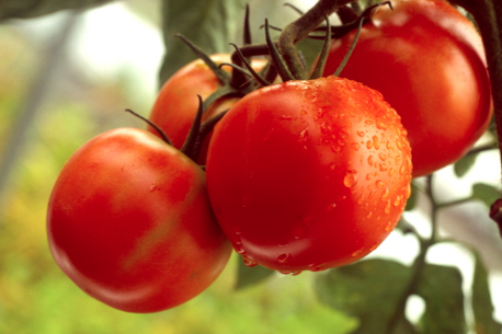
Hamakua Springs, which started out growing bananas and then expanded into growing the deliciously sweet hydroponic tomatoes we all know the farm for, has other crops as well.

tomatoes.jpgThese days there are farmers leasing small plots where they are growing taro, corn, ginger and sweet potato. These farmers’ products go to the Hamakua Springs packing house and Hamakua Springs distributes them, which speaks to Richard’s goal of providing a place for local farmers to farm, wherethere is water and packing and distribution already in place.

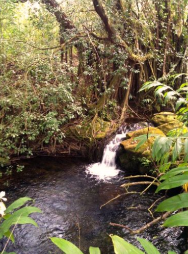
As we drove, we saw a lot of the water that passes through his farm. There are three streams and three springs. It’s an enormous amount of water, and it’s because of all this water that he was able to develop his brand new hydroelectric system, where they are getting ready to throw the switch.

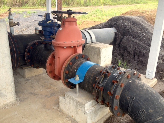
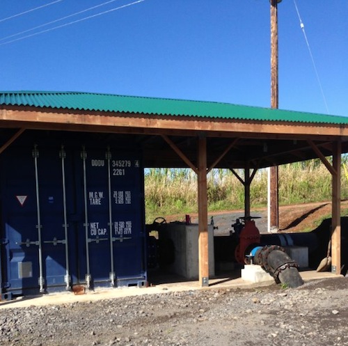
The water wasn’t running through there the day we were there because they’d had to temporarily “turn it off” – divert the water – in order to fix something, but we could see how the water from an old plantation flume now runs through the headworks and through a pipe and into the turbine, which is housed in a blue shipping container.

hydro.jpg

This is where the electricity is generated, and I was interested to see a lone electric pole standing there next to the system. End of the line! Or start of the line, really, as that’s where the electricity from the turbine is carried to. And from there, it works its way across the electric lines stretched between new poles reaching across the land.

Screen Shot 2013-06-06 at 11.17.00 PM

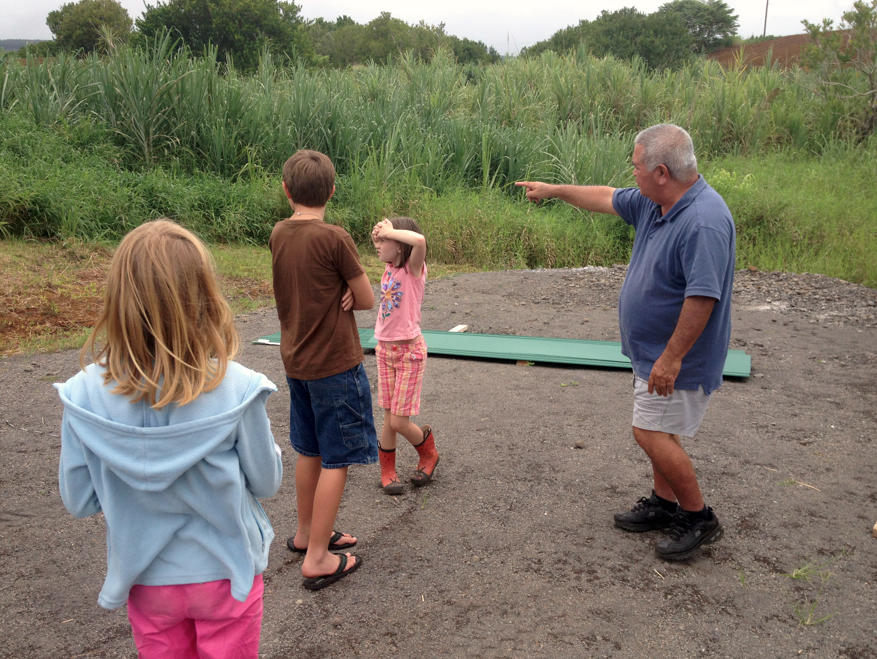
He asked the children who were along with us for their ideas
about how to landscape around the hydroelectric area, and also where the water leaves the turbine to run out and rejoin the stream.

Screen Shot 2013-06-06 at 11.17.00 PM

“We could do anything here,” he said, asking for thoughts, and
we all came up with numerous ideas, some fanciful. Trees and grass? A taro lo‘i? Maybe a picnic area, or a water flume ride or a demonstration garden or fishponds?

There are interesting plans for once the hydro system is operating, including a certified kitchen where local area producers can bring their products and create value-added goods.

Other plans include having some sort of demo of sustainable
farming, and perhaps ag-tourism ativities like walking trails going through the farm, and maybe even a B&B. “The basis of all tourism,” he said, “is sustainability.”

Hamakua Springs is also experimenting with growing mushrooms
now, and looking into several other possibilities for using its free
electricity.

As we stopped and looked at the streams we kept coming
across, which ran under the old plantation roads we drove upon, Richard made an observation that I found interesting. In the Hawaiian way, the land is thought of as following the streams down from mountain to sea. In traditional ways, paths generally ran up-and-down the hill, following the shape of the ahupua‘a.

“But look at the plantation roads,” he said, and he pointed
out how they run across the land, from stream to stream. The plantation way was the opposite. Not “wrong” – just different.

Richard has plans to plant bamboo on the south sides of the
streams, which will keep the water cool and keep out invasive species.

At the farm, they continue to experiment with raising
tilapia
, which are in four blue pools next to the reservoir.

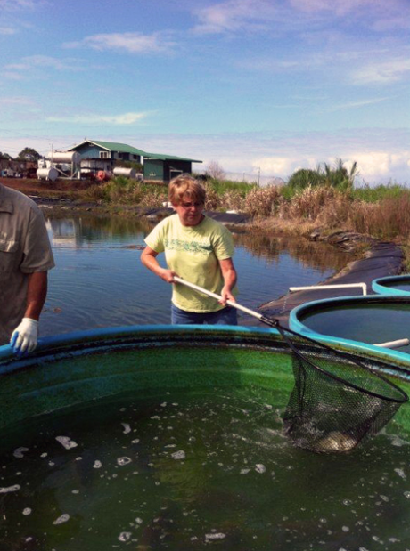
June & Tilapia.jpgJune with a full net

The pools are at different heights because they are using gravity to flow the water from one pool to the next, rather than a pump. Besides it being free, this oxygenates the water as it falls into the next pool. They are not raising the fish commercially at present, but give them to their workers.

Everything that Richard does is geared toward achieving the same goal, and that is to keep his farm economically viable and sustainable.

If farmers make money, farmers will farm.

Continuing to farm means continuing to provide food for the local community, employing people locally and making it possible for local people to stay in Hawai‘i: This as opposed to people having to leave the islands, or their children having to leave the islands, in order to make a decent life for themselves.

The hydroelectric system means saving thousands per month in
electric bills, and being able to expand into other products and activities. It means the farm stays in business and provides for the surrounding community. It means people have jobs.

This is the same reason why, on a bigger scale, Richard is working to bring more geothermal into the mix on the Big Island: to decrease the stranglehold that high electricity costs have over us, so the rubbah slippah folk have breathing room, so that we all have more disposable income – which will, in turn, drive our local economy and make our islands more competitive with the rest of the world, and our standard of living higher, comparably.

When he says “rubbah slippah folk,” Richard told me, he’s always thinking first about the farm’s workers.

This, by the way, is really a great overview of how Richard describes the “big picture.” It’s a TEDx talk he did awhile back (17 minutes). Really worth a look.

It was so interesting to see firsthand what is going on at the farm right now, and hear about the plans and the wheres and whyfors. Thank you, Richard, for a really interesting and insightful afternoon.

Visitors To The Farm

Richard Ha writes:

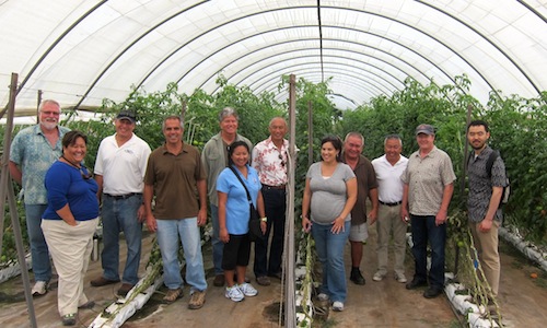
We had a lot of visitors one day last week. All, like us, were very excited about the possibilities surrounding ag and energy at the farm. Agriculture and energy are inextricably intertwined.

The visit was arranged by Matt Hamabata, Chief Executive Officer of the Kohala Center, of which I am a board member. He brought researchers from Cornell University, as well as representatives from UH Hilo and Kamehameha Schools.

Main

From UH Hilo, Cam Muir and consultant Greg Chun. From Cornell, Max Zhang and Robert J. Thomas. Matt Hamabata from Kohala Center. From Kamehameha Schools, Mahealani Matsuzaki, Neil Hannahs, Giorgio Caldarone, Sydney Keliipuleole, Llewelyn Yee and Marissa Harman.

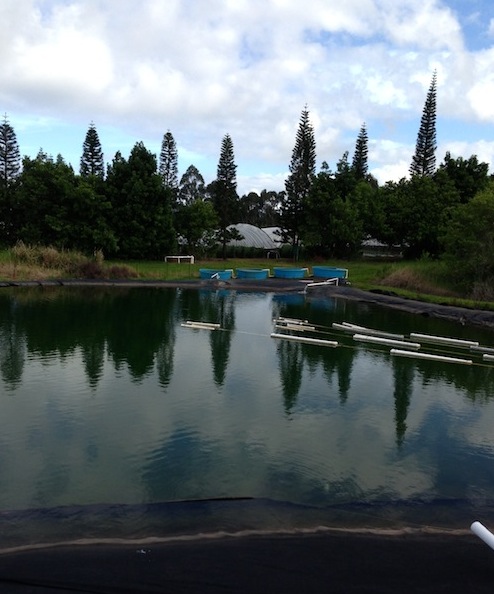
This reservoir supplies all the irrigation water for our vegetables. The water comes down from an intermittent stream. Soon, the water pumps that move the water and pressurize the lines will be electrified from the old plantation flume.

Biodiesel tank 023

See the blue tanks in the distance? That’s a tilapia experiment, where we oxygenate the water by using falling water rather than electricity. This is another way to leverage the abundant water that falls on the farm: We get 2.3 billion gallons annually on our 600-acre farm.

James&Kimo

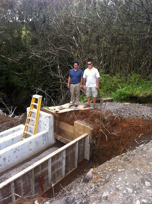
Construction of the head works: connecting up the old part of the flume with the new part. (Left) James Channels, produce buyer for Foodland Supermarkets and (right) Kimo Pa, farm manager at Hamakua Springs.

We took them up to the head works, where the old part of the flume system joins up with the new. As we looked downslope, someone mentioned how amazing it is to think that the sugar people moved the sugar cane to the mill by portable wooden
flume structures that they moved from field to field. We were standing about three miles upstream of the sugar mill.

Next we went to the hydro turbine shack to see where the water we borrowed 150 feet upslope is returned to the flume after energy is extracted. From there, overhead lines take the electricity to our packing house.

Turbine before

The turbine before

Turbine after

The turbine after
We have a vision of lining the south side of the flume with native trees. Their shadows would fall across the flume and suppress invasive species at the same time.
Back at the packing house, I told them about diversifying our produce mix. A papaya farmer wants to work with us, producing and labeling non-GMO papayas. Also, I visited an organic farmer in Opihikao yesterday. He is interested in getting heat-sterilized coconut coir to use as media for his certified clean ginger seed business. I told him I will keep him in the loop.

Later, Laverne Omori, the new Research and Development Director, came by with County Energy Coordinator Will Rolston. Vincent Kimura, of the INNOVI group, was at the farm helping us install an ozone food sanitation system. The beauty of this system is that we won’t have to use chemicals for sanitation treatment.
The only thing left over will be plain water.

Here’s a “before” picture with some previous visitors, Claire Sullivan and Steve Carey from Whole Foods.

Claire&Steve

And this short video shows “after.”

We want to use the electricity we get from the river to help area farmers produce more food. The bottom-line, inescapable fact is that if the farmers make money, the farmers will farm.